
SPEED
In comparison to traditional ground survey methods, we can cut the data collection time by 80%.
PRECISION
Using the latest LiDAR technology with ground control points, data can be produced down to a high level of precision.
ABOUT ADS
OUR STORY
With a background in surveying and constuction, we have embraced the latest technologies to reduce costs, increase speed and maximize safety on everyday mapping applications and aerial progression photographs.
OUR STORY
With a background in surveying and constuction, we have embraced the latest technologies to reduce costs, increase speed and maximize safety on everyday mapping applications and aerial progression photographs.
ABOUT US
With a military background, we understand our clients' need for on-time job completion, problem solving and decision making skills to deliver proven results.
ABOUT US
With a military background, we understand our clients' need for on-time job completion, problem solving and decision making skills to deliver proven results.
OUR SERVICES
We offer aerial mapping topography, 3D modeling, and construction site progression photos as well as insurance and safety inspection photos.
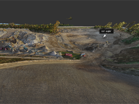
3D MODELING
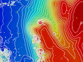
RBG ELEVATIONS
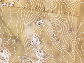
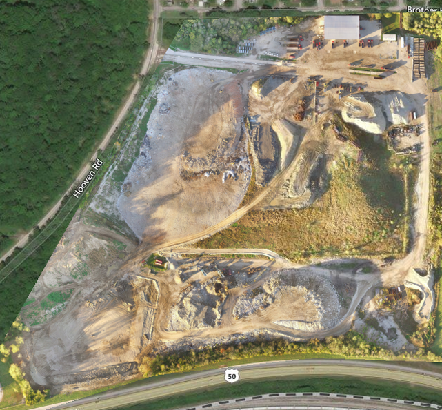
TOPOGRAPHY
1012 Hartford Circle
Lawrenceburg Indiana. 47025 USA
advanced-drone-solutions.com
(513) 257 8906